WINTERMAN XTREME TRIATHLON
YOU CAN FIND ALL ACTUAL MAPS HERE: https://www.czxtri.com/race-manual/
SWIM COURSE GARMIN – short version 2024
SWIM COURSE MAP – short version 2024
Swim
- 3.8km = 8.9km down in Labe river
- start – jump from platform
- darkness, cold water, strong current, 30 buoys
Bike
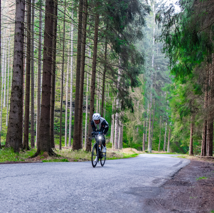
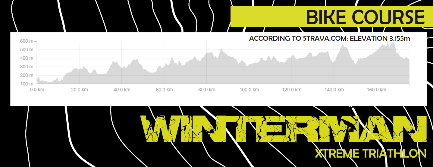
- 180km beautiful scenic route
- over 3300m elevation
- Up&Down, Zig-Zag technical route
Run
- 43km
- 1200m elevation
- Last 11km extreme climb
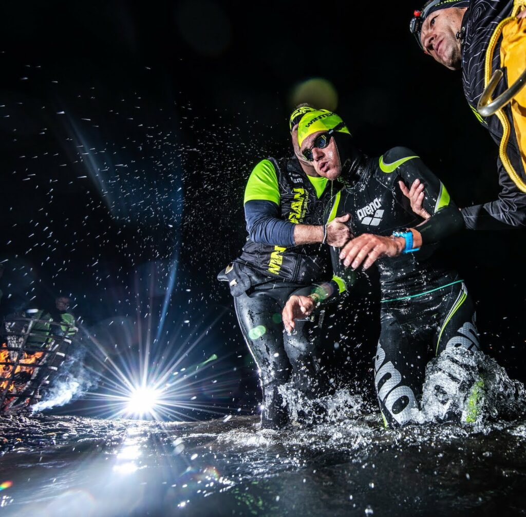
SWIM
is unique and World class extreme
8.9 km down stream swim,
darkness, whirpools and cold water
30 river buoys and very fast river current swim
You will be dragged into a power of emotions and the beautiful experience of winterman swimming, you will not experience anything like this anywhere else in the World!
The start is on the right bank of the Elbe, behind the village of Jakuby.
The journey from T1 to the start takes about 15 minutes.
The start is at 5:30am (it‘s absolutel’y dark!)
The swim is about 9 km downstream – very fast and dark downstream!
The start is a 2m jump into the river from the platform.
The speed of the current varies according to the current state and flow of water, expect 4 – 5 km/h sometimes up to 6 km/h.
The biggest challenge is to watch out the buoys, they are 30 of theme.
Expect a much faster swimming time than you usually have!
The water is cold, the temperature can be between 10 and 13 degrees Celsius, the last 500m will cool down to 7 ´C.
SWIM EXIT is located bellow the 3rd bridge and it will be illuminated by fire on the right bank.
BIKE
There is one way scenic route of 180km.
The total elevation of the bike part is more than 3300m.
The whole course is up&down – zigzag and narrow roads
It goes with full public traffic.
You`ll actually follow the National Park for quite a long time up to the North part of the Czech Republic where you turn down again to the romantic Lusatian Mountains. The road is narrow and it goes zigzag and up and down.
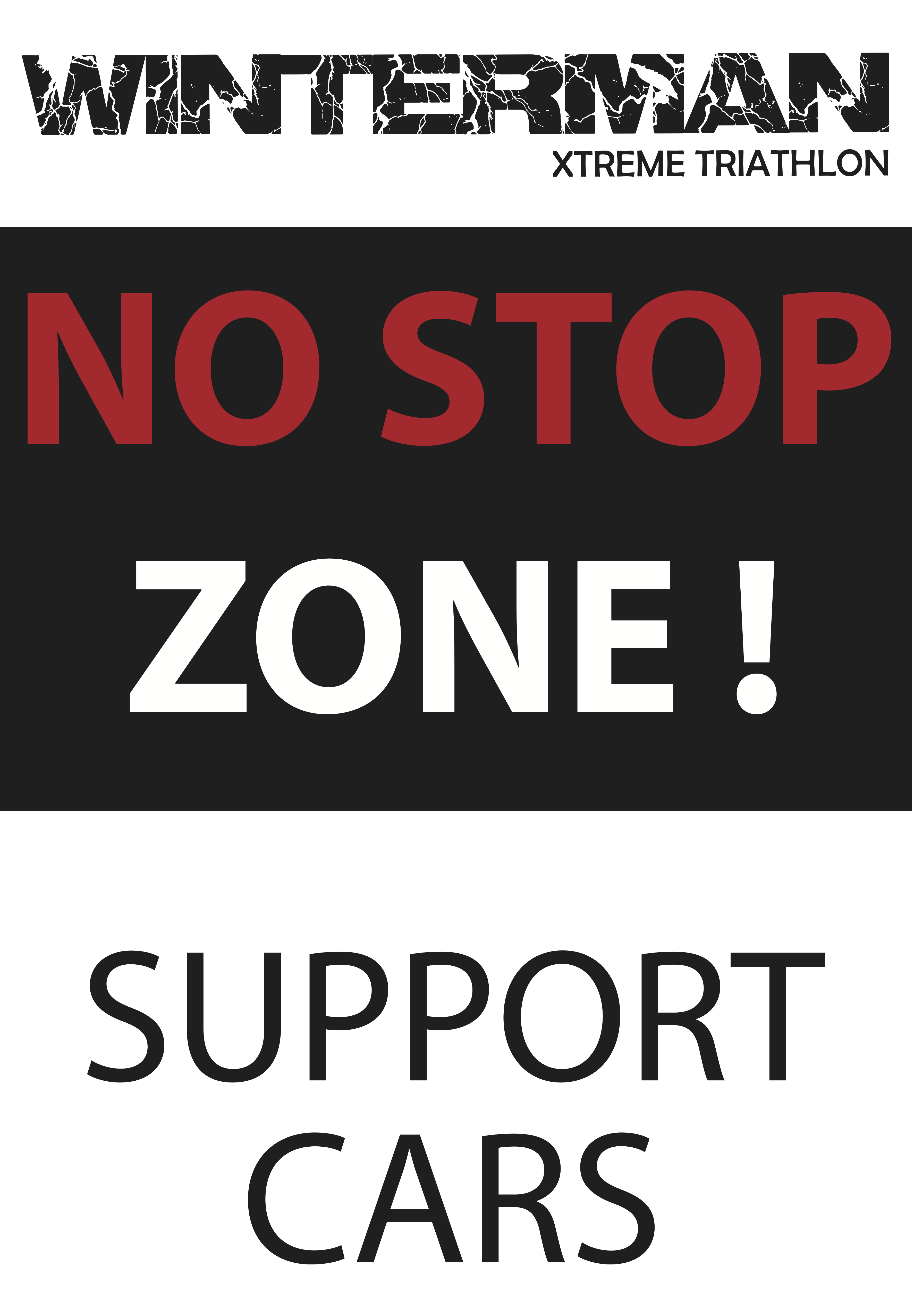
The bike route has 2 NO SUPPORT ZONES, where it is forbidden to PARK, SUPPORT AND STOP !!
1. NoSupport zone 14-30km, starts at the end of Hřensko, ends in Jetřichovice.
2. NoSupport zone 67-82km, starts behind the village Studený, ends in Krásný Buk.
Violation of parking is penalized 5 minutes, repeated violation is disqualification!
Both support zones are there for safety and smooth traffic operation, located in the National Park.
Minimum distance for drafting is 15 meters.
The total ascent of the cycling part is around 3300 m.
The whole route leads on very good tarmac.
The cycling part takes place during full road traffic, there are many intersections, railway crossings and several traffic lights.
All obstacles and all road traffic are part of the race.
The organizer does not guarantee a smooth passage!
You will receive detailed information and maps in the race manual.
BIKE COURSE:
Děčín Smetanovo Nábřeží ( T 1) – následující obce: Hřensko, Vysoká Lípa, Jetřichovice, Srbská Kamenice, Růžová, Janov, Arnoltice, Bynovec, Kámen, Srbská Kamenice, Jánská, Česká Kamenice, Studený, Chřibská, Doubice, Kyjov, Krásný Buk, Brtníky, Mikulášovice, Vilémov, Dolní Poustevna, Lobendava, Lipová, Šluknov, Rumburk, Krásná Lípa, Rybniště, Chřibská, Česká Kamenice, Mlýny, Kytlice, Horní Světlá, Mařenice v Podještědí – Resort Malevil ( T2 )
RESPECTING TRAFFIC REGULATIONS
- You race in full traffic and you are a road user
- It is absolutely necessary to obey traffic rules
- Athlete is not excluded from traffic rules and does not take precedence over the others
- Support is not allowed to stop other cars to help a ride of their athlete
- Support car must park by all four wheels off the road or off the white side line only!
Violence of this rule will cause the 5minutes penalty. Duplicated violence of this rule will cause immediate disqualification - There is an immediate disqualification for the passage of traffic lights and railway crossings to the red light, with the signaling device running or the barriers retracted.
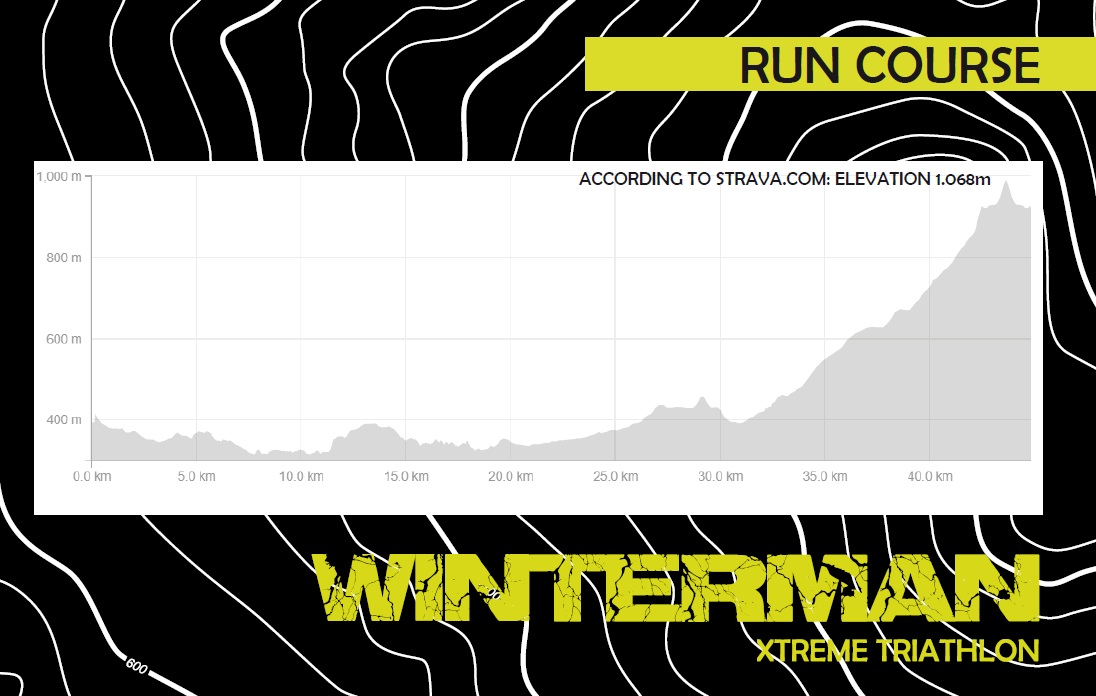
RUN
43km, of which a total of 11km trail – off road, the rest is on an tarmac road
The last 11km is extremly steep climb, the final KM to the top lead along the rocks and boulders
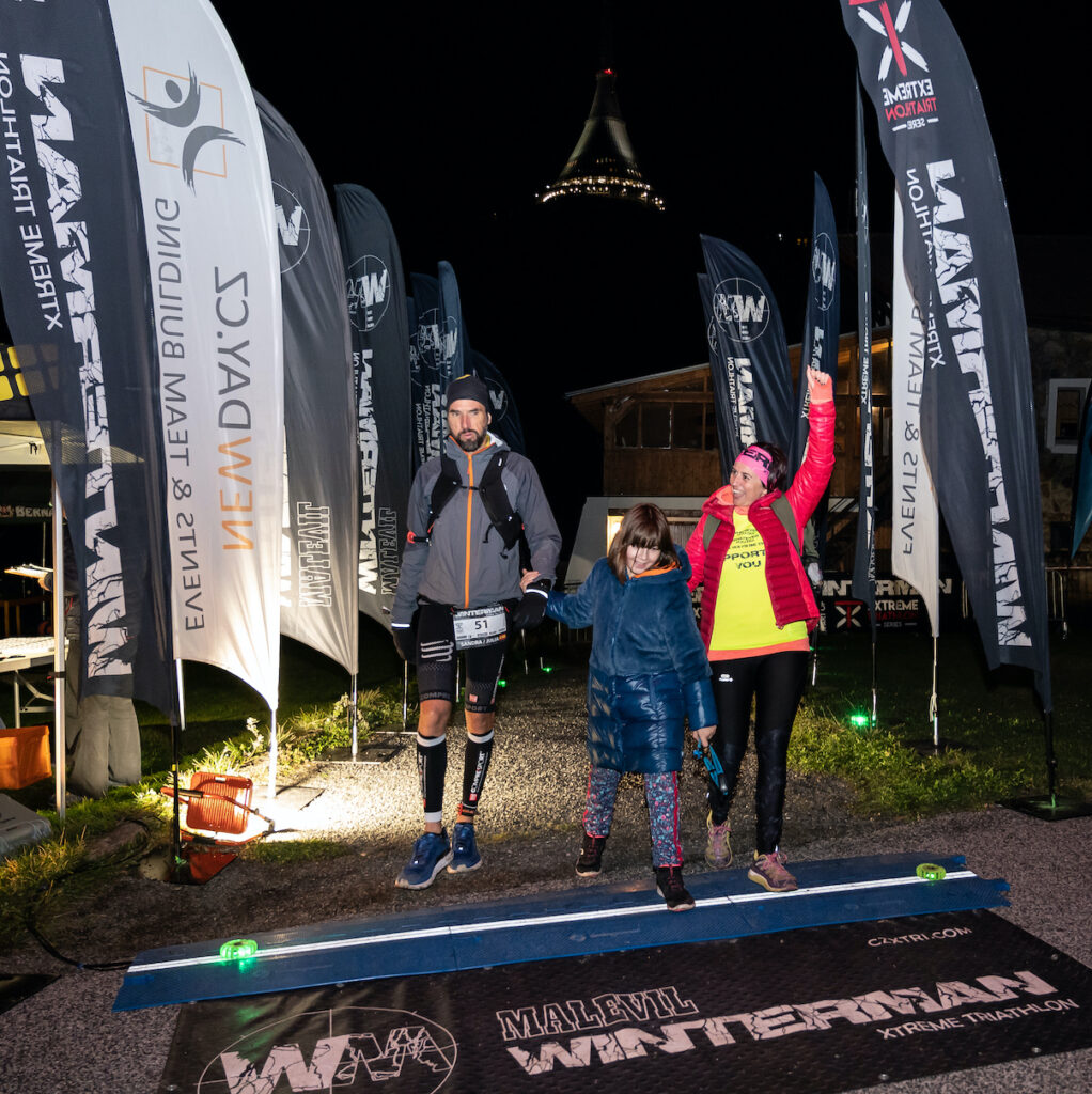
The finish is below the top of Ještěd 1012 m above sea level
From 5 pm it is mandatory to have the headlamp, flashing light and reflective straps on
The finish point the iconic peak of Jested is visible almost from all of the run part even at night.
The first 10km are trail sections off the road, 30km of the running route is on tarmac.
At 32km – about 300m behind the village Janův Důl is RACE CHECK POINT, you must be here no later than 22:00.
The last 11km is an extreme climb to the highest point and Winterman’s goal to the top of Ještěd 1012m above the sea level.
From 42 km you must run to the finish line with your support.
There is a limited number of parking spaces in the finish car park. Free parking is guaranteed for cars marked with the WM sticker .
From 17:00 and in case of reduced visibility, each competitor must have a headlamp, a red flashing strip and reflective strips – you will receive it from the organizer.
In the running part, the competitor can be accompanied by an escort. He can run or ride a bike. But he can never be in front of a athlete. He/she must always be behind a athlete! If it is a runner, he/she can be next to the competitor. Escort by bike is possible only up to 32km, the condition is that he/she must always ride on the right side of the road at a distance behind the athlete so as not to block traffic on the road.
Remember that only official support (in a T-shirt), can serve snacks and other services!
There is only one official support.
You will receive the details in the race manual.
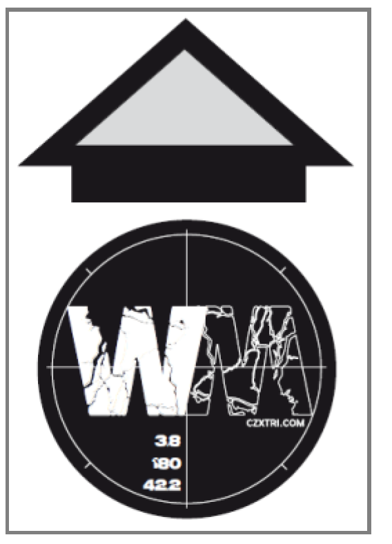
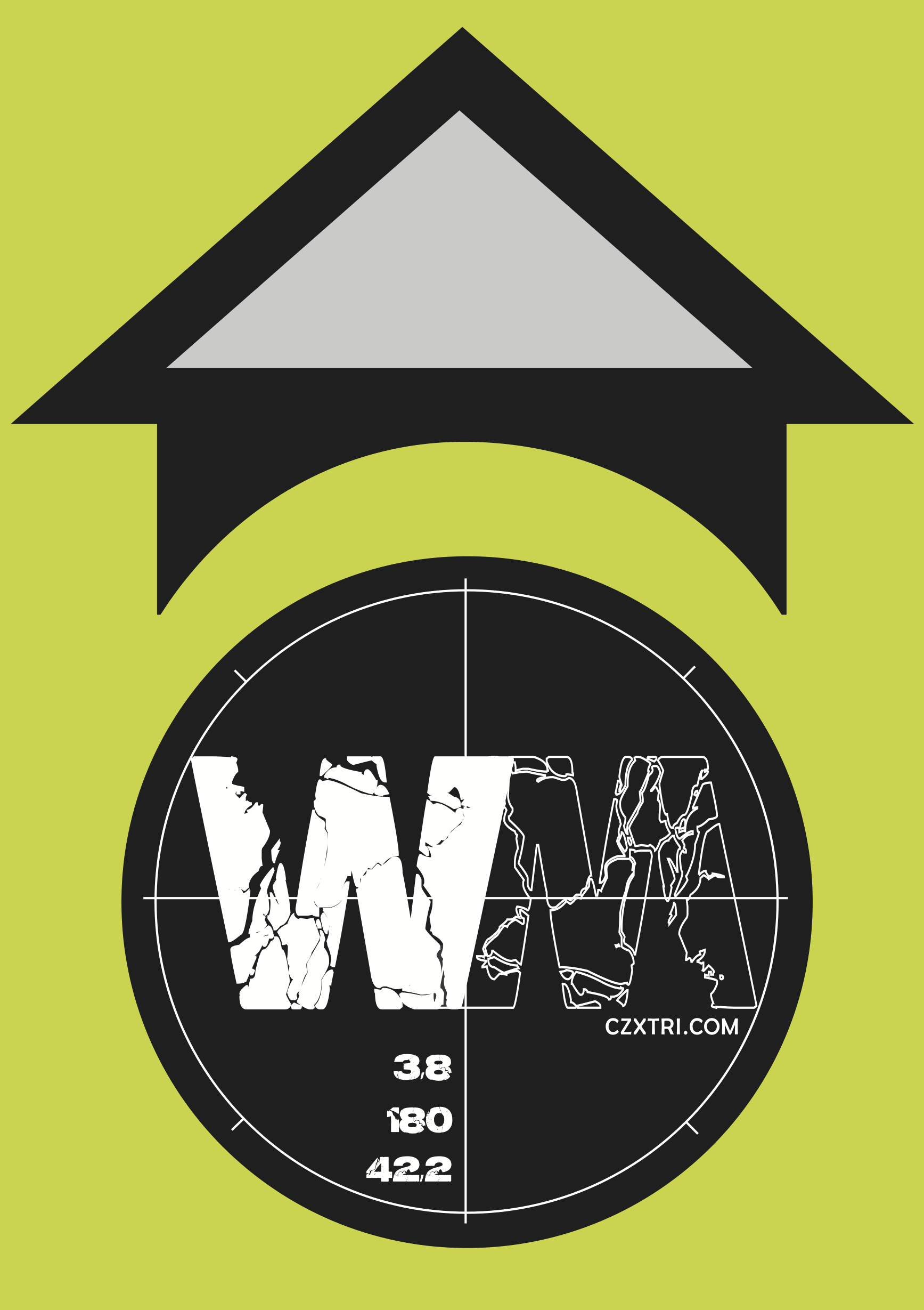
Signs and orientation during the race:
- The course is primary signed by an arrow with WM placed on vertical road signs – direction indicator
- The NO SUPPORT ZONE is marked with a large road sign „NO STOP ZONE!“
- Every important and radical change of direction is signed with an arrow with WM / vertical road signs – direction indicator
- Every turn off the main road is signed before the junction with an arrow with WM / vertical road signs – direction indicator
- Every turn off the main road is signed behind the junction with a straight arrow with WM / vertical road signs – direction indicator
- The route is signed along all its length with arrows with WM
- Arrow is placed on a “High road” road sign
- Arrow is always placed on a “Stop” road sign
- Arrow is always placed on a vertical road signs „direction indicator left, right or straight“
- Arrow is always placed on a road sign at the „beginning or end of a municipality“ /name of village or city/
- Arrow is always placed on the places with difficult orientation
- Arrow is placed on a long stretches without any turns
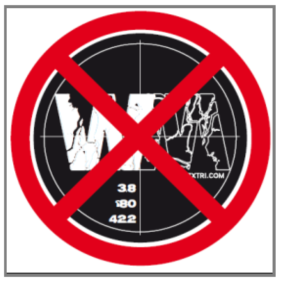
- Several very unclear junctions are marked with a red cross over the WM arrow on the wrong exit